
more than a daytrip
Winter Hiking
Six of the Best Winter Hikes
IN THE ST. CROIX VALLEY

Hikes That Will Make You Wish Winter Would Last Forever.
Why hike the St. Croix Valley in the winter? With summer walkers in hibernation, peace and solitude reign in the woodlands. Busy waters have stilled and are capped with sheets of ice that only the most ambitious currents can escape. Spectacular views are enhanced by dustings of white glitter. Gone are the pesky insects and thick, stifling mugginess of summer. Crisp and cool air infuses the soul with energy and invigorates the body in a way that only the cold-weather months can inspire.
Not convinced? Try these 6 hikes and decide for yourself.
The biggest draw to the St. Croix Valley, and the Taylors Falls, MN and St. Croix Falls, WI area is the St. Croix River itself. Mighty glacier meltwaters bulldozed through volcanic basalt and oceanic sandstone leaving some of the most phenomenal geology in the world in its wake. Veteran summertime hikers may find these trail choices a bit obvious, but when viewed through the white lens of winter, a whole new world of frozen vistas emerges. Since navigating icy terrain can sometimes be tricky, hikes contained within state parks offer the advantage of an up-to-date trail report and advice from park personnel based on current conditions. The following trails all are family-friendly, allow leashed pets, and usually avoid skiers. A day pass is required for a minimal fee on state park trails.
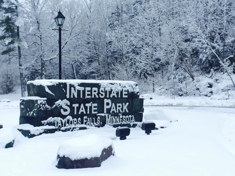
1. Walter mondale River Trail–Glacial Potholes Area
Interstate Park, Taylors Falls, MN Degree of Difficulty in Winter: Moderate Distance/Type: 1.75 miles/linear
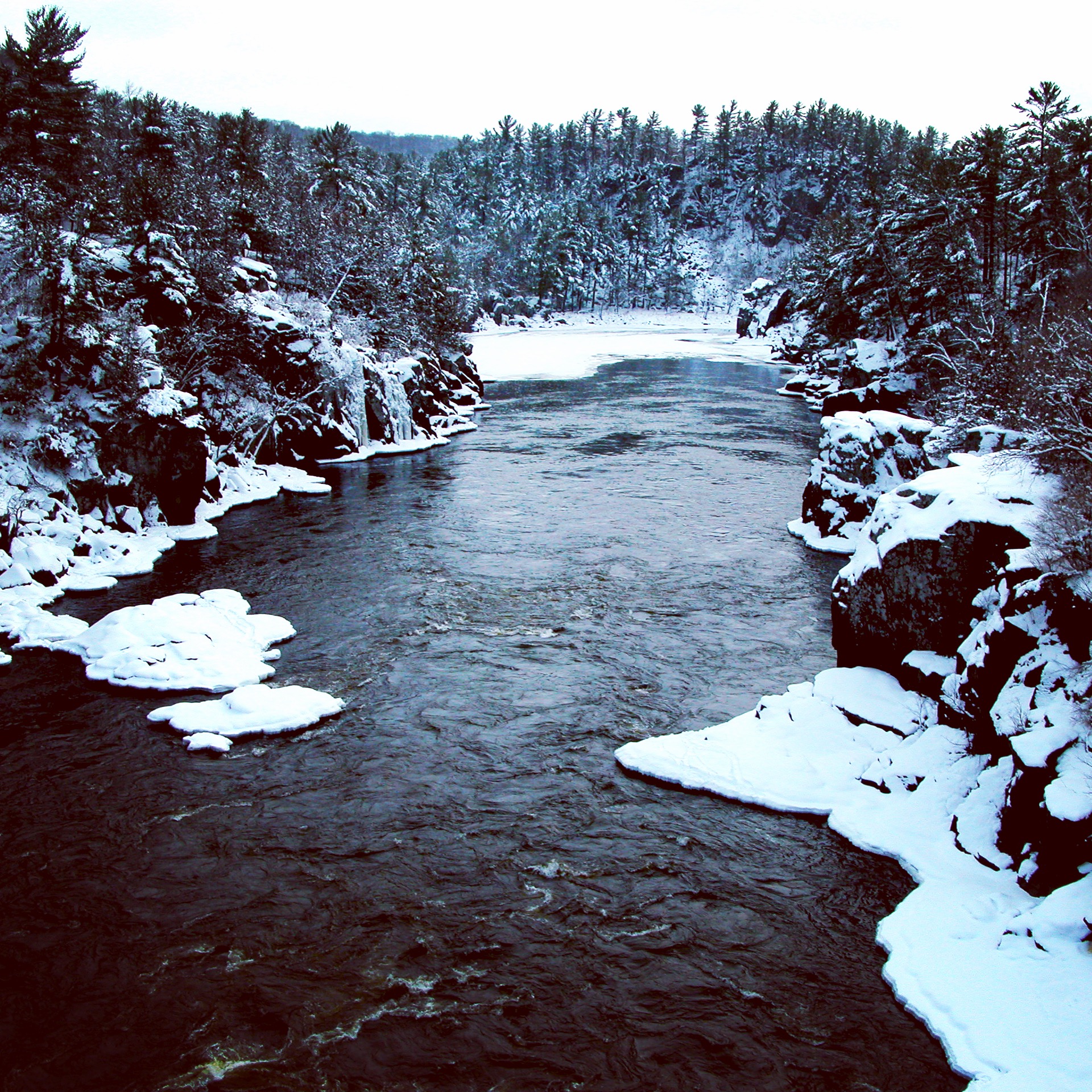
The Walter Mondale River Trail runs for about 1.25 miles alongside the St. Croix River, gradually escalating until you find yourself high up on the bluffs, ensconced in breathtaking aerial views. Winter’s touch brings icy patches to the rolling, rocky terrain, adding a few inclines and declines that can be tasking to surmount. The traffic from busy Highway 8, running parallel to the trail, detracts from the peacefulness, but the magnificent landscape makes it worth it. The River Trail culminates in the city of Taylors Falls where you can choose to loop back along the Railroad Trail on the other side of Highway 8 or continue on to the Glacial Potholes Area.
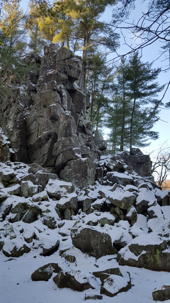
Interstate Park contains the largest concentration of potholes in a small area in the world, making it more than tempting to tack on an extra half-mile to your hike. It also contains the deepest pothole in the world, measuring in at almost 60 feet deep. These impressive formations could only exist under a specific set of ancient circumstances: a heavy rush of glacial meltwater carrying sediment that swirled and drilled into hard, volcanic basalt, with softer sandstone downstream eroding swiftly to create a waterfall. The Glacial Pothole Area features several tiers of pothole formations along a twisting pathway of stairs and ramps. Snow glitters around the mouths of these geological wonders and sheets of ice cap the smallest ones, contributing to a visual that is nothing short of the true meaning of awesome. Most of the potholes are well-guarded with railings or natural barriers, but extreme caution should be exercised, especially if hiking with small children. See more here: Interstate Park Minnesota Trail Map


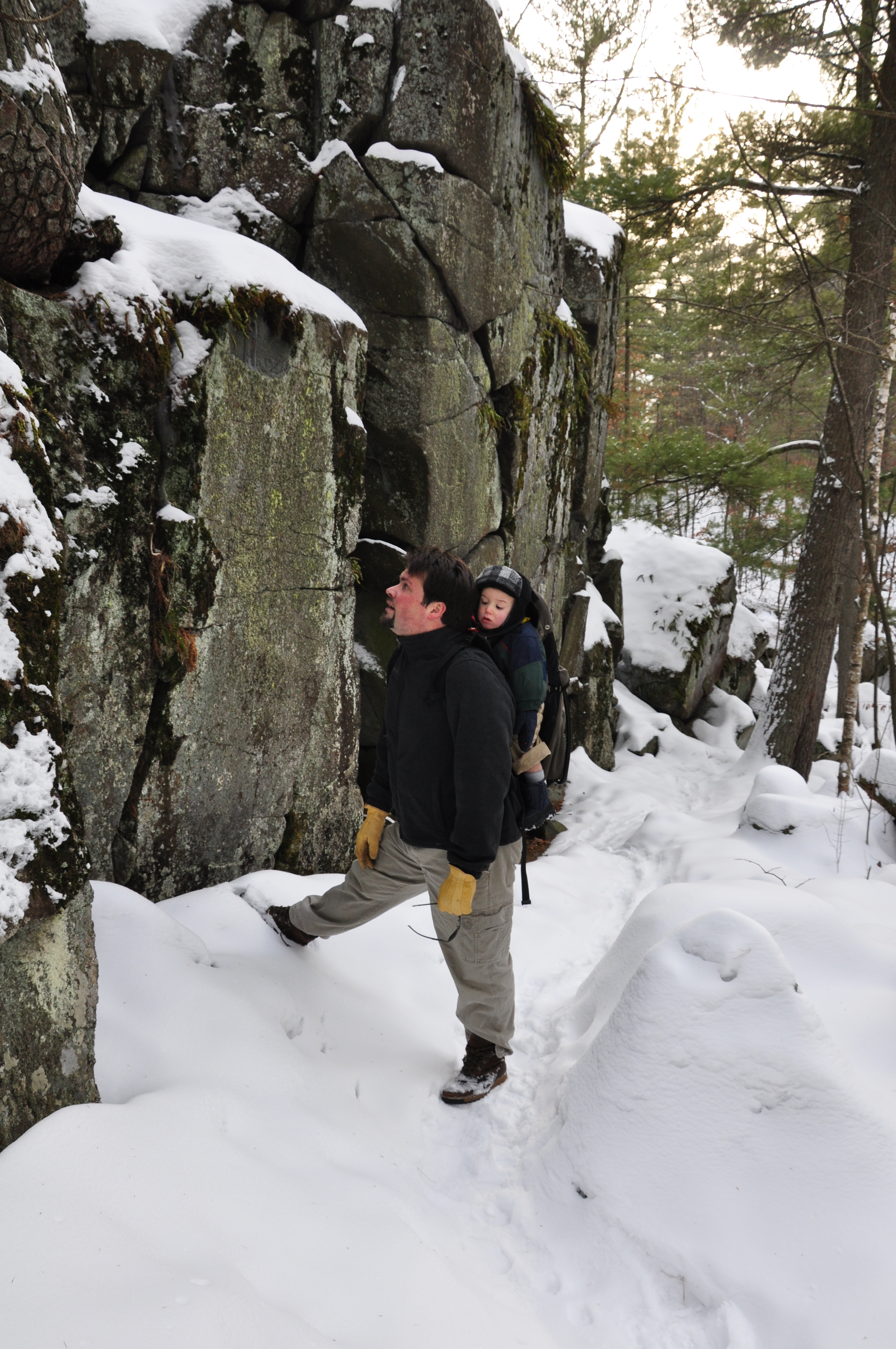
2. Lake O’ the Dalles–Echo Canyon– Summit Rock Trails
Interstate Park, St. Croix Falls, WI Degree of Difficulty in Winter: Challenging Distance/Type: 1 mile/loop
The shores of the picturesque, snow-covered Lake O’ the Dalles mark the path to Echo Canyon located on its northwestern tip. Lake O’ the Dalles Trail continues for one mile around the circumference of the lake, but the trailhead for Echo Canyon veers off at approximately .3 miles along. The low, flat pathway of the canyon, bordered on both sides by a sloping, rocky talus obscured slightly by snow, inspires a feeling of tranquil isolation. Upon cresting a rise of stone steps where the Echo Canyon loop intersects with Summit Rock Trail, the impressive Old Man of the Dalles appears. The weathered face of the Old Man seems chiseled into the rocky outcropping, though he is a completely natural phenomenon, and snowy boulders gather at his feet like subjects bowing to the throne. The steep, rocky landscape at this point can be tricky to traverse, especially when covered in ice, but once through this gauntlet, the St. Croix River awaits in all its wintry splendor. Summit Rock Trail continues along the bank, offering prime river vistas backgrounded by the bluffs on the other side, then curves around through the forest and leads back to the Lake O’ the Dalles. See more here: Interstate Park Wisconsin Trail Map
3. River Terrace Loop
Wild River State Park, Center City, MN Degree of Difficulty in Winter: Easy Distance/Type: 1.5 miles/loop
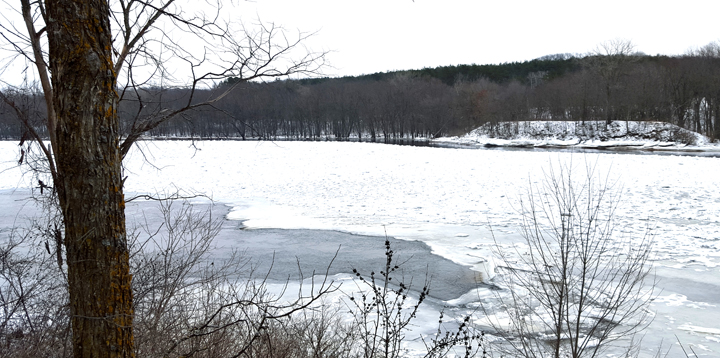
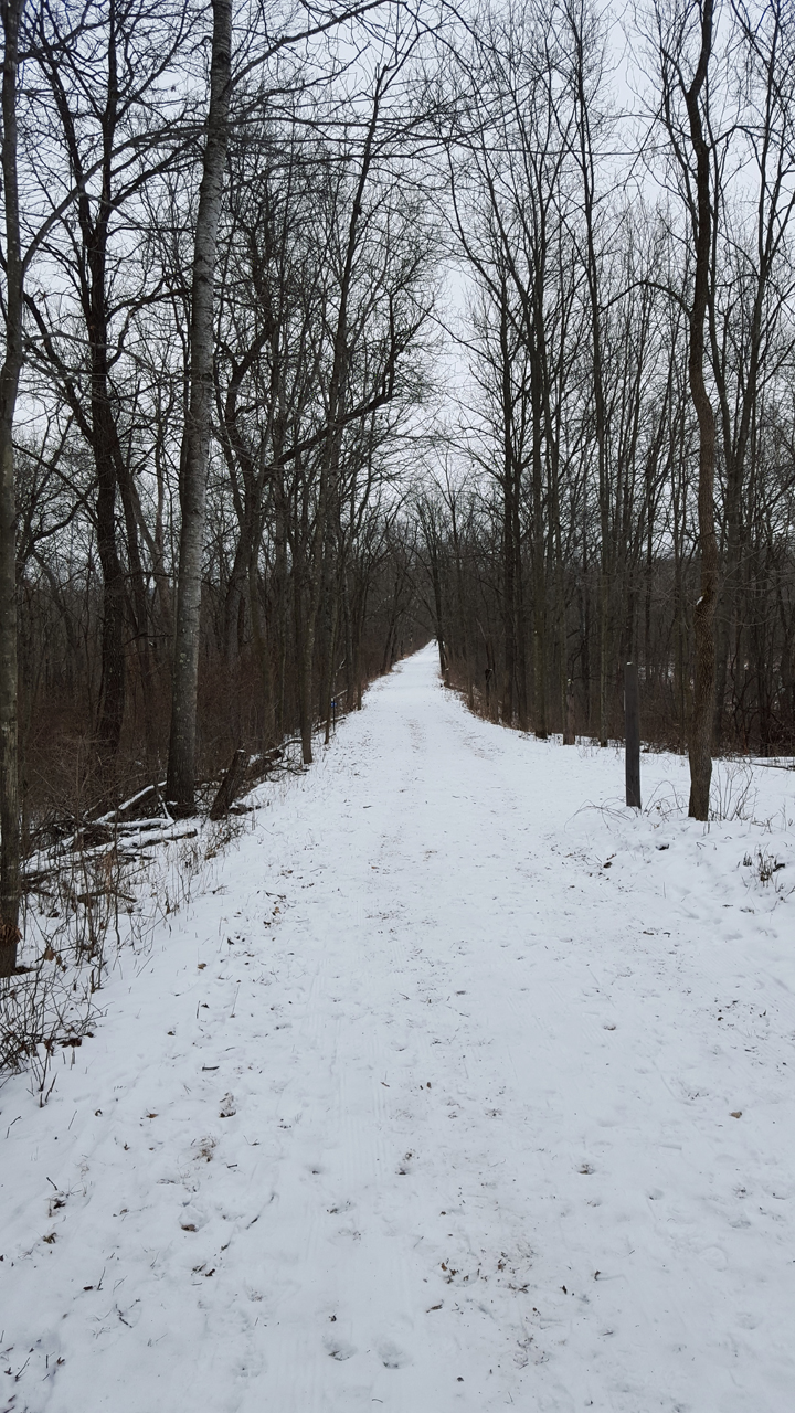
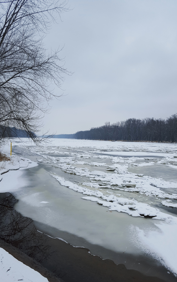
The River Terrace Loop commences through .3 miles of scenic forest leading to an overlook of the former site of Nevers Dam. A display outlines the history of the dam built during the logging era to control the flood of logs headed downstream on the wild St. Croix. From here, the aptly named River Terrace Loop sits atop a short plateau that spans .6 miles along the river. In contrast to the bluff trails of the valley, the River Terrace Loop is situated low along the shoreline allowing for zoomed-in views of the choppy waters that froze into sheets of ice mid-chop and came to rest leaning upon one another. The river portion of the trail eventually gives way to an uphill rise into a tranquil forest that circles back to the trailhead. Tracks from various woodland creatures can be easily spotted on a soft blanket of snow. The River Terrace Loop is an immaculately groomed, double-wide, multi-use trail for skiing on one side and hikers/snowshoers on the other. To avoid skiers, try the Amiks Pond loop which intersects with skiers for only .3 miles along the river bank. See more here: Wild River State Park Trail Map
4. Ice Age National Scenic Trail: hospital Esker Segment
St. Croix Falls, WI Degree of Difficulty in Winter: Easy Distance/Type: .5 miles/linear
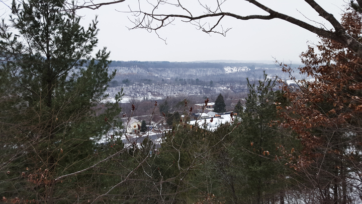
In seeking to hike the geology of the River Valley, the call of the esker rings loudly. The Hospital Esker Segment of the Ice Age National Scenic Trail offers an easy glimpse at this snaking ridge of sand, gravel, and boulders formed by an ancient stream that once ran beneath a glacier. The Ice Age Trail winds for over a thousand miles throughout Wisconsin, but the Esker Segment can be accessed directly in St. Croix Falls. A reasonably fit person will have little trouble mounting the ridge from street level and once atop its back, it only gets easier. The sparsely wooded forest allows peeks of the city that sprung up on both sides of this glacial landform and although traffic zooms all around, there is a certain serenity in walking atop the very spine of nature, touched by winter’s magic, that brings about a humbling peace. From the summit of the esker, the St. Croix River can be viewed as deceptively calm in the distance. See more here: Ice Age National Scenic Trail: Hospital Esker Segment
5. Riverside Trail
William O’Brien State Park, Marine on St. Croix, WI Degree of Difficulty Winter: Easy Distance/Type: 2 miles/loop
After following the roadway under Highway 95 and down into the woods, the Riverside Trail slopes in tandem with a hardy spring, refusing to freeze with the cold, down into the floodplain forest. Wooded with silver maple and cottonwood trees, the floodplain forest, noticeably devoid of underbrush, is nestled up against the St. Croix River. Majestic river views decorated with layered sheets of ice hail to the left while a stoic white forest provides an escort to the right. Halfway along the river path, the floodplain gives way to stately white pines, now large and mighty, but only seedlings during the logging heyday of the late 1800s/early 1900s. A notable glacial erratic boulder weighing 20 tons stands watch along the trail from beneath a frozen pate of snow. The path then cuts through park features such as an amphitheater and pavilion before emerging along the banks beautiful Lake Alice, guarded on the west by a wooded hillside. The trail continues north along the shoreline to the initial roadway. It is a well-groomed trail, maintained throughout the winter for hiking and snowshoeing. See more here: William O’Brien State Park.
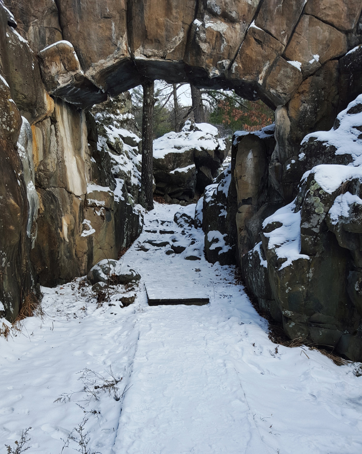
St. Croix Falls, WI Degree of Difficulty in Winter: Moderate Distance/Type: .4 miles/loop
The western terminus of the 1,200 mile National Scenic Ice Age Trail starts right at the Pothole Trail inside Interstate Park, WI. The Pothole Trail is the most geologically unique trail in the park and is just a short hike to scenic views of the Dalles of the St. Croix River gorge. Walk atop Old Man of the Dalles rock formation and past world-famous potholes formed by glacial meltwaters.
See more here: Interstate State Park – WI
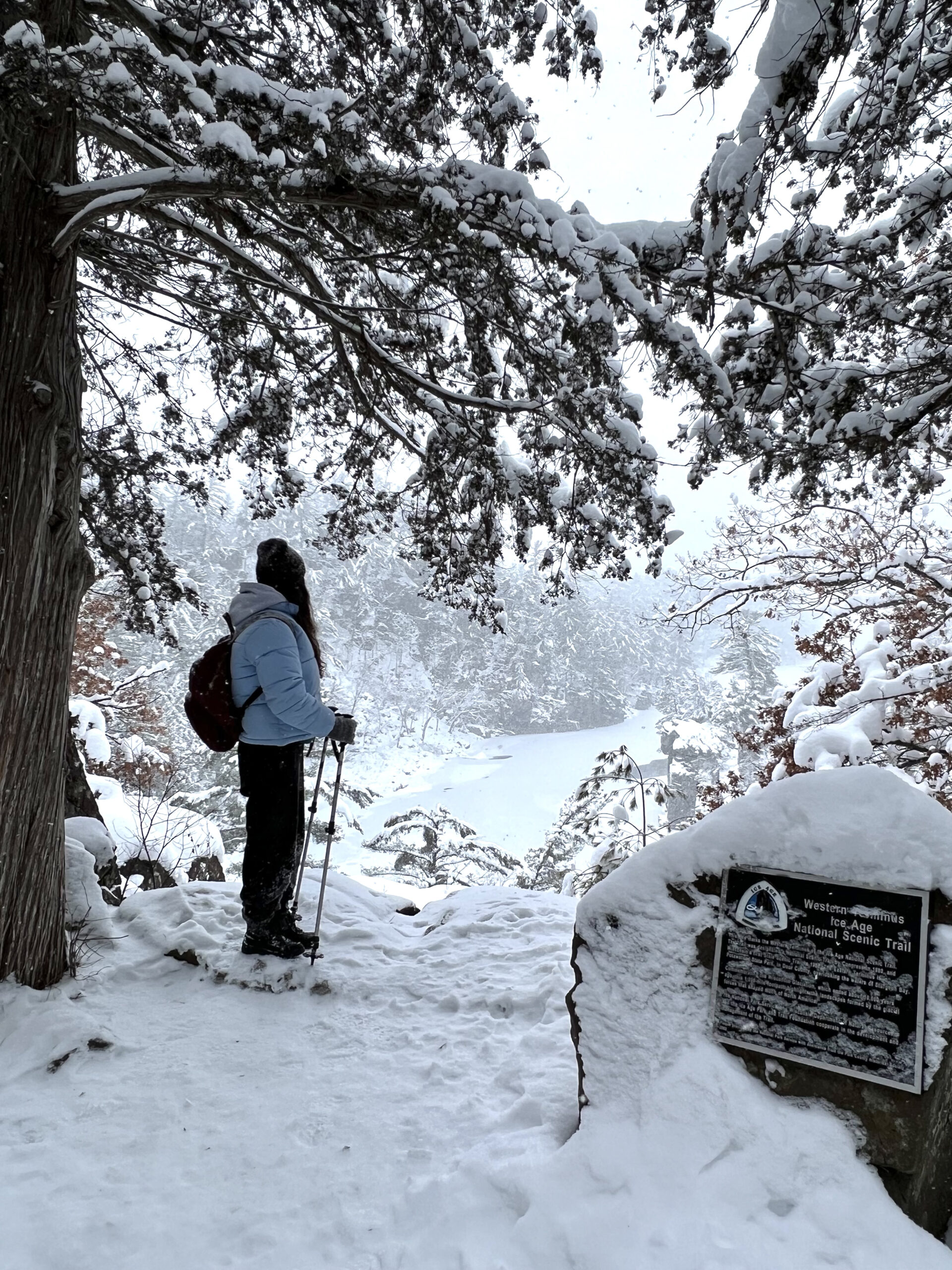
photo © Andrea shakal
Notable mention - Cascade Falls Trail
Osceola, WI Degree of Difficulty in Winter: Moderate
While the stairs to Cascade Falls is closed right now, you can still reach the falls by starting your hike on Simenstad Trail, continuing along the Eagle Bluff Trail, and following the Cascade River Trail directly to the falls. You’ll enjoy the payoff with a glorious view of Cascade Falls in all her winter finery. Boulders encased in ice and topped with snow give the appearance of frozen bubbles at the foot of the cascade. Giant icicles dangle from the eaves of the cliff face from which she falls. Sandwiched between a couple busy roads, the hum of traffic is drowned out by the crashing of the falls and muffled by the babbling of the brook. The trail follows the stream which empties into the St. Croix River at a snow-capped rockslide. A series of bridges blanketed in fluffy white provide a sturdy, flat surface for much of the way, but as with all winter hikes, a careful step is wise. See more here: Osceola Trails
Osceola, WI Degree of Difficulty in Winter: Moderate Distance/Type: .3 miles/loop
Right off of Main St. in Osceola, the most difficult part of the trail is the 135 steps down to the trailhead. It’s an immediate payoff at the bottom with a glorious view of Cascade Falls in all her winter finery. Boulders encased in ice and topped with snow give the appearance of frozen bubbles at the foot of the cascade. Giant icicles dangle from the eaves of the cliff face from which she falls. Sandwiched between a couple busy roads, the hum of traffic is drowned out by the crashing of the falls and muffled by the babbling of the brook. The trail follows the stream which empties into the St. Croix River at a snow-capped rockslide. A series of bridges blanketed in fluffy white provide a sturdy, flat surface for much of the way, but as with all winter hikes, a careful step is wise. See more here: Osceola Trails
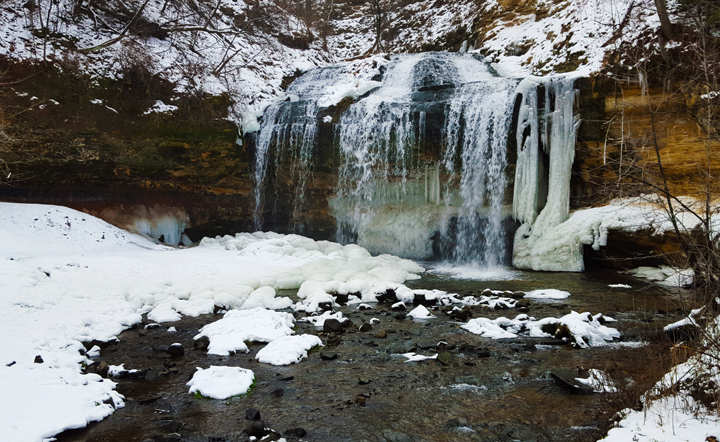
photo © Andrea shakal
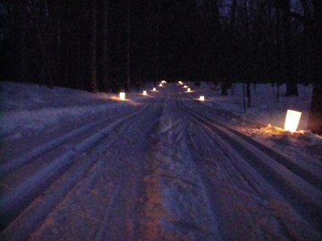
Hike, snowshoe, or ski by candlelight
Try a hike by candlelight and you will be hooked on winter hiking for good. Area candlelight hike/ski/snowshoe events provide an opportunity to bask in the serene and snowy forest lit only by the soft glow of candles along the path. A bonfire, refreshments, and live entertainment await you at the end. See our events page to check for upcoming dates.
This article was written by Karen Lawrence, newly initiated winter hike addict and edited/produced by Linda Shober Marketing + Design LLC, a marketing firm located in the St. Croix Valley specializing in providing content, strategy, management, design, and creative for digital and traditional marketing projects.