
DRESSER AND OSCEOLA TRAILS

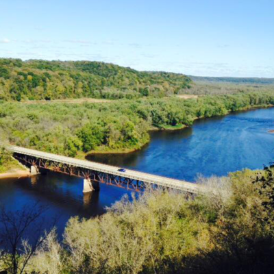
Dresser, WI and Osceola, WI are located just a few miles down river from the St. Croix Falls & Taylors Falls area. Be sure to include these cool towns in your trail explorations.
Find your favorite trail!
osceola, wi
Cool little River town located along the st. croix River.
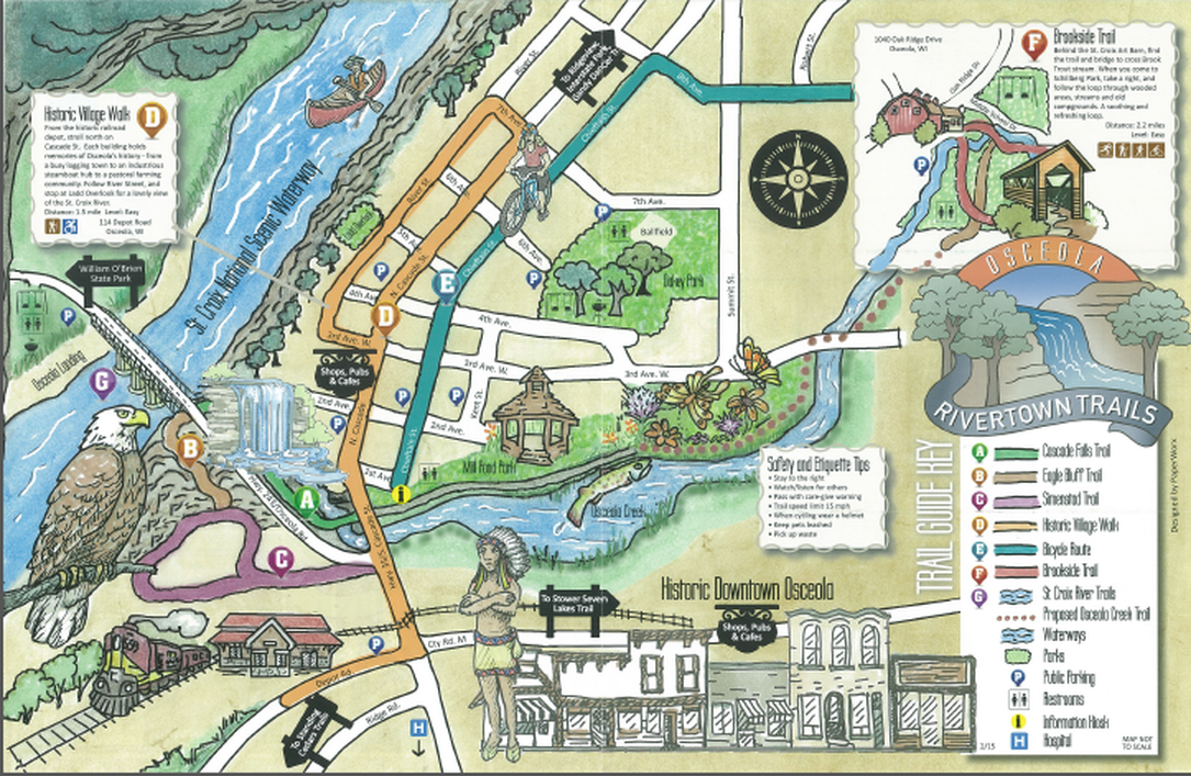
There are plenty of trails both in-town and along the countryside in Osceola. Check out the trails within the Village, as well as at Standing Cedars Conservancy and the Ridgeview trails just off of County Road S.
VILLAGE OF OSCEOLA
The Falls Bluff Trail loop includes the Cascade Falls Trail, Eagle Bluff Trail, and the Simenstad Trail which will give you spectacular views of the St. Croix River, a gushing waterfall, woodland trails, and the city of Osceola.
DIFFICULTY LEVEL: INTERMEDIATE
SIMENSTAD TRAIL
TRAIL USES:
SUMMER: HIKING
WINTER: HIKING, SNOWSHOEING
Trailhead address:
Downtown Osceola.
MAP IT
Look for the Geiger Brewery ruins and climb the steps to the Picnic Bluff. Loop around for sweeping views of the St. Croix River.
TRAIL TYPE: FOOT TRAFFIC
TRAIL LEVEL: INTERMEDIATE
SURFACE: NATURAL
PASS REQUIRED: NO
LENGTH: 1 MILE LOOP
NOTABLES: Be careful on cliff edges.
DIFFICULTY LEVEL: intermediate
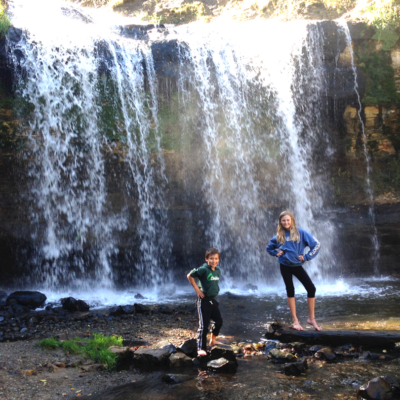
CASCADE FALLS TRAIL
TRAIL USES:
SUMMER: HIKING
WINTER: hIKING
Trailhead address:
Downtown Osceola.
MAP IT
Trail begins with a staircase of 135 wooden stairs to reach the breathtaking Cascade Falls. Continue along the stream to reach the St. Croix River.
TRAIL TYPE: FOOT TRAFFIC
TRAIL LEVEL: INTERMEDIATE
SURFACE: STAIRS, NATURAL SURFACE
PASS REQUIRED: NO
LENGTH: .3 MILE LINEAR
NOTABLES: At dusk, the falls are illuminated with colorful lighting.
DIFFICULTY LEVEL:coming soon
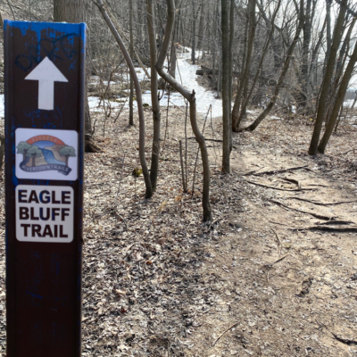
EAGLE BLUFF TRAIL
TRAIL USES:
SUMMER: HIKING
WINTER: HIKING
Trailhead address:
Downtown Osceola.
MAP IT
Access this trail by following the Cascade Falls Trail. At the river, follow the rustic, switchback trail to reach the top of the bluff and link to Simenstand Trail.
TRAIL TYPE: FOOT TRAFFIC
TRAIL LEVEL: INTERMEDIATE TO ADVANCED
SURFACE: NATURAL
PASS REQUIRED: NO
LENGTH: 1 MILE LINEAR
NOTABLES: This is a challenging trail with steep grades, but the views at the top are worth the climb.
DIFFICULTY LEVEL: easy
BROOKSIDE TRAIL AT SCHILLBERG PARK
TRAIL USES:
SUMMER: HIKING, MTB bIKING
WINTER: hIKING, SKIING, SNOWSHOEING, FAT BIKING
Trailhead address:
1041 Oak Ridge Drive
Osceola, WI
MAP IT
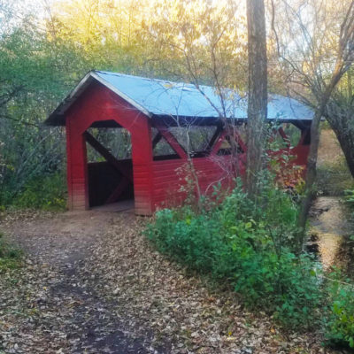
This in-town trail is behind the St. Croix Art Barn and crosses Brook Trout Stream by way of a beautiful covered bridge.
TRAIL TYPE: FOOT AND BIKE TRAFFIC
TRAIL LEVEL: EASY
SURFACE: NATURAL
PASS REQUIRED: NO
LENGTH: 2.5 MILE LOOP
NOTABLES: This trail is groomed for Fat Tire biking in the winter. Please follow trail etiquette when encountering a groomed trail.
PHOTO © C. PRATT

DIFFICULTY LEVEL: easy
JEFF MEYER PUBLIC FITNESS TRAIL
TRAIL USES:
SUMMER: HIKING, bIKING, INLINE SKATING
WINTER: HIKING
Paved trail outside the Osceola Medical Center Campus and Wild River Fitness Center. Outdoor exercise equipment found along the trail. RCU Sport Court and Inclusive Playground available for public use.
TRAIL TYPE: FOOT TRAFFIC
TRAIL LEVEL: EASY
SURFACE: PAVED
PASS REQUIRED: NO
LENGTH: .5 MILES
NOTABLES: Fully Accessible. Not maintained during the winter.
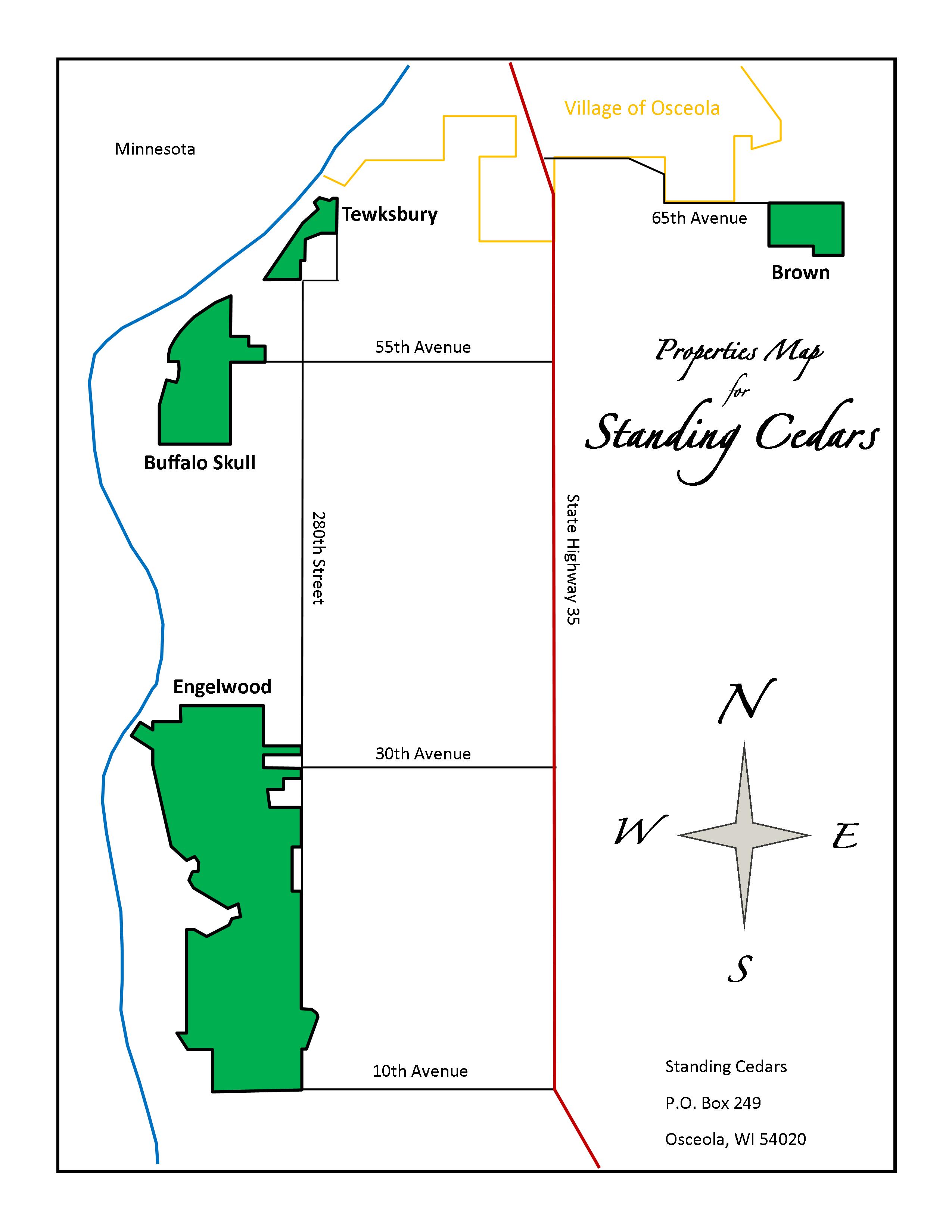
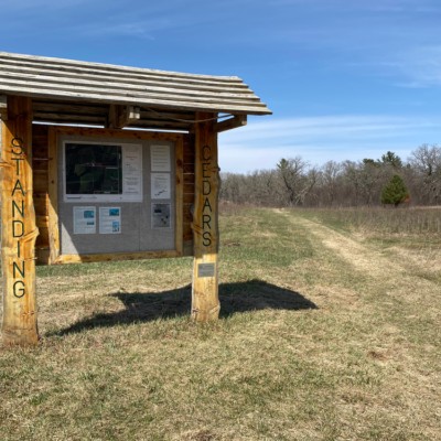
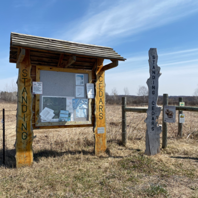
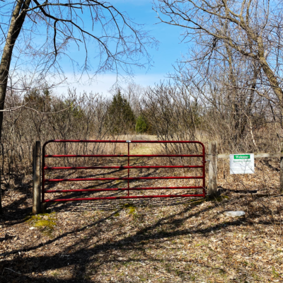
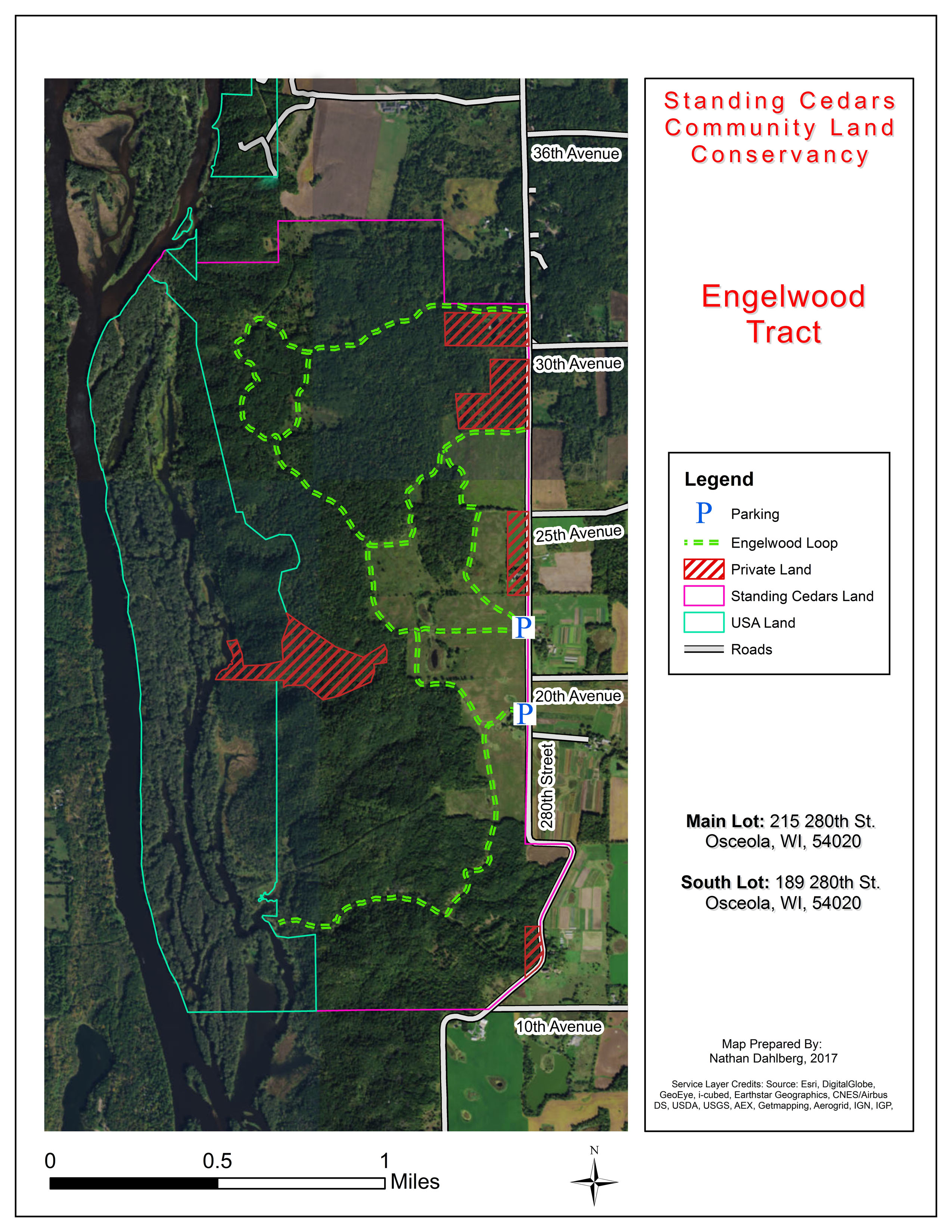
STANDING CEDARS COMMUNITY LAND CONSERVANCY
The forests, fields, and bluff lands along the Lower St. Croix River are vibrant and beautiful natural areas. Three ecosystems converge here: Northern Boreal Forest, Eastern Hardwood, and Tall Grass Prairie. Over 1,500 acres are protected in the Standing Cedars Conservancy, with four areas open to the public.
DIFFICULTY LEVEL:EASY
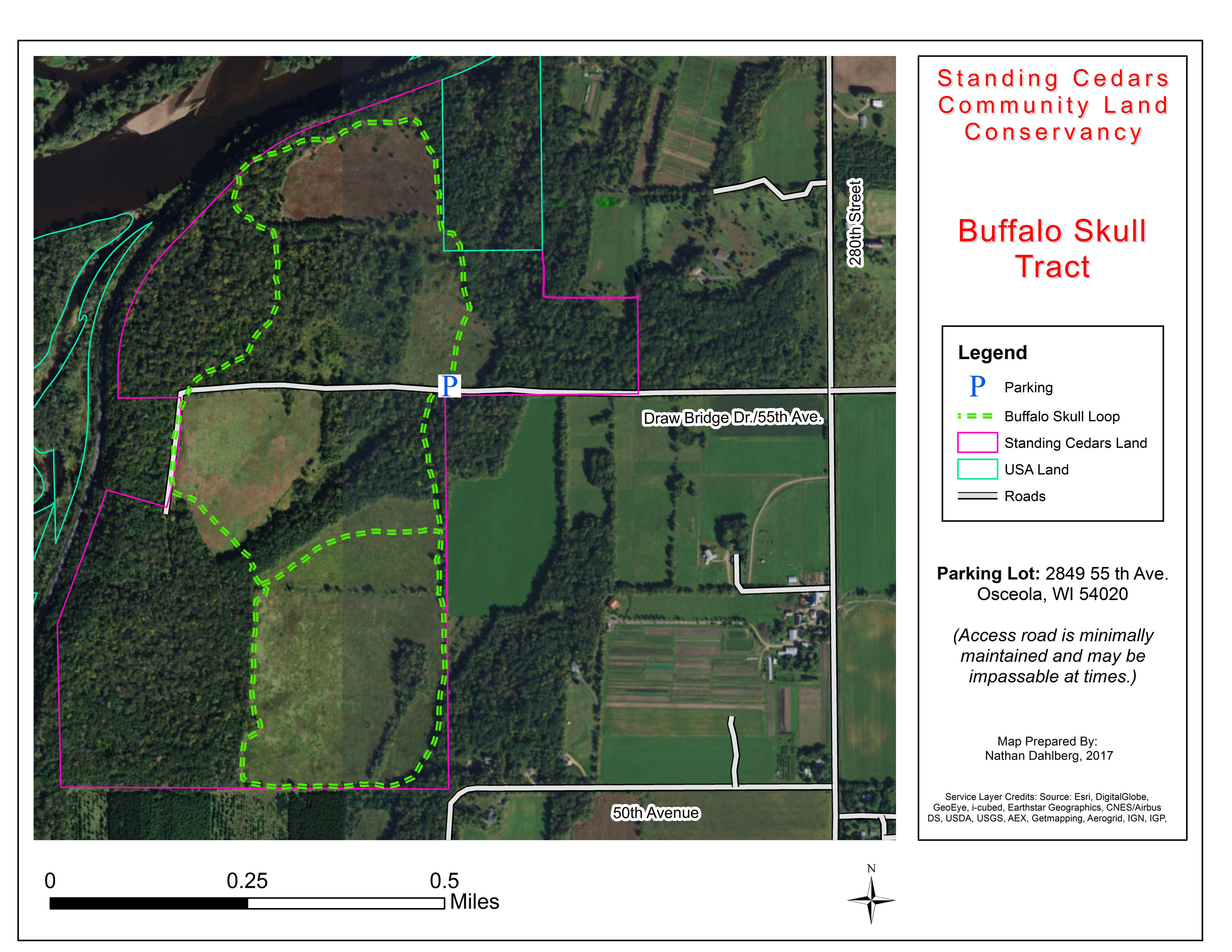
BUFFALO SKULL
TRAIL USES:
SUMMER: HIKING
WINTER: HIKING, SNOWSHOE
Trailhead address:
2849 55th Ave
Osceola, WI 54020
MAP IT
There are many interesting areas to explore on this 245-acre property, including dry cliffs, oak savanna, a moist ravine, maple/basswood forest, and former farm fields. A 25-acre pasture on the north side of the property that is full of prairie plants. Standing Cedars has removed many of the cedar trees that had been taking over this area and has been burning and mowing to setback the sumac, prickly ash and other invasive plants.
TRAIL TYPE: FOOT TRAFFIC
TRAIL LEVEL: EASY
SURFACE: NATURAL
PASS REQUIRED: NO
LENGTH: 245 ACRES
NOTABLES: Dry cliffs, oak savanna, maple and basswood forest.
DIFFICULTY LEVEL: easy
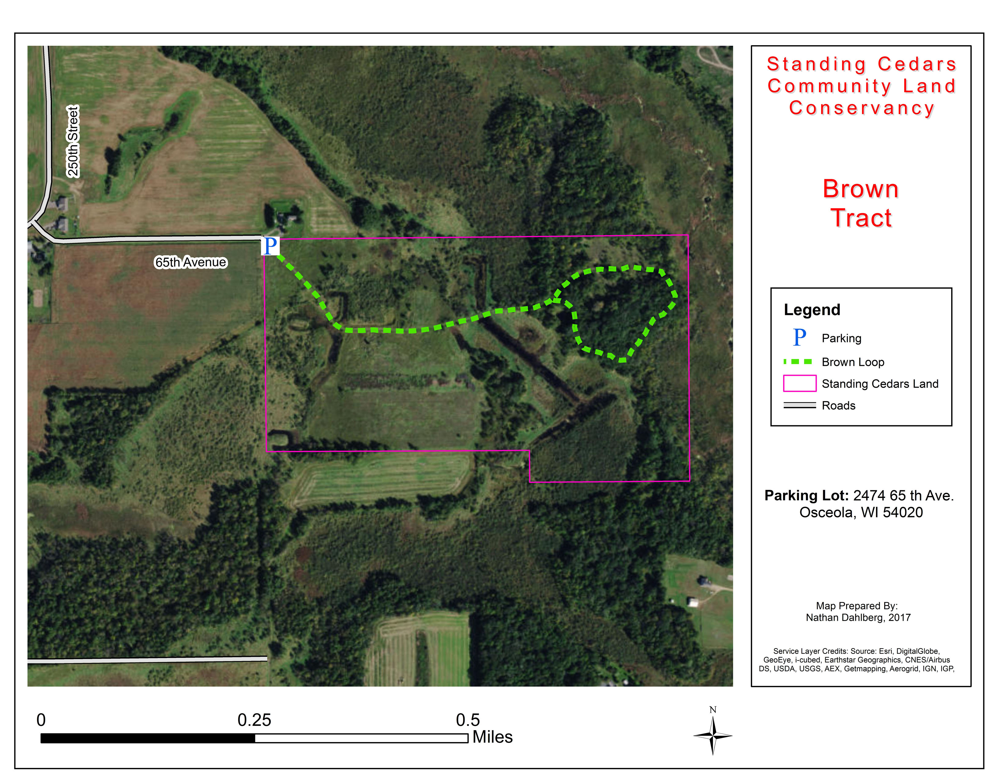
BROWN TRAIL
TRAIL USES:
SUMMER: HIKING
WINTER: hIKING, SNOWSHOEING
Brown the most recent stand alone property and spans 84 acres.
Trailhead address
2474 65th Ave
Osceola, WI 54020
MAP IT
TRAIL TYPE: FOOT TRAFFIC
TRAIL LEVEL: EASY
SURFACE: NATURAL
PASS REQUIRED: NO
LENGTH: 84 ACRES
NOTABLES: This is the newest acquisition of a stand-alone property.
DIFFICULTY LEVEL: EASY
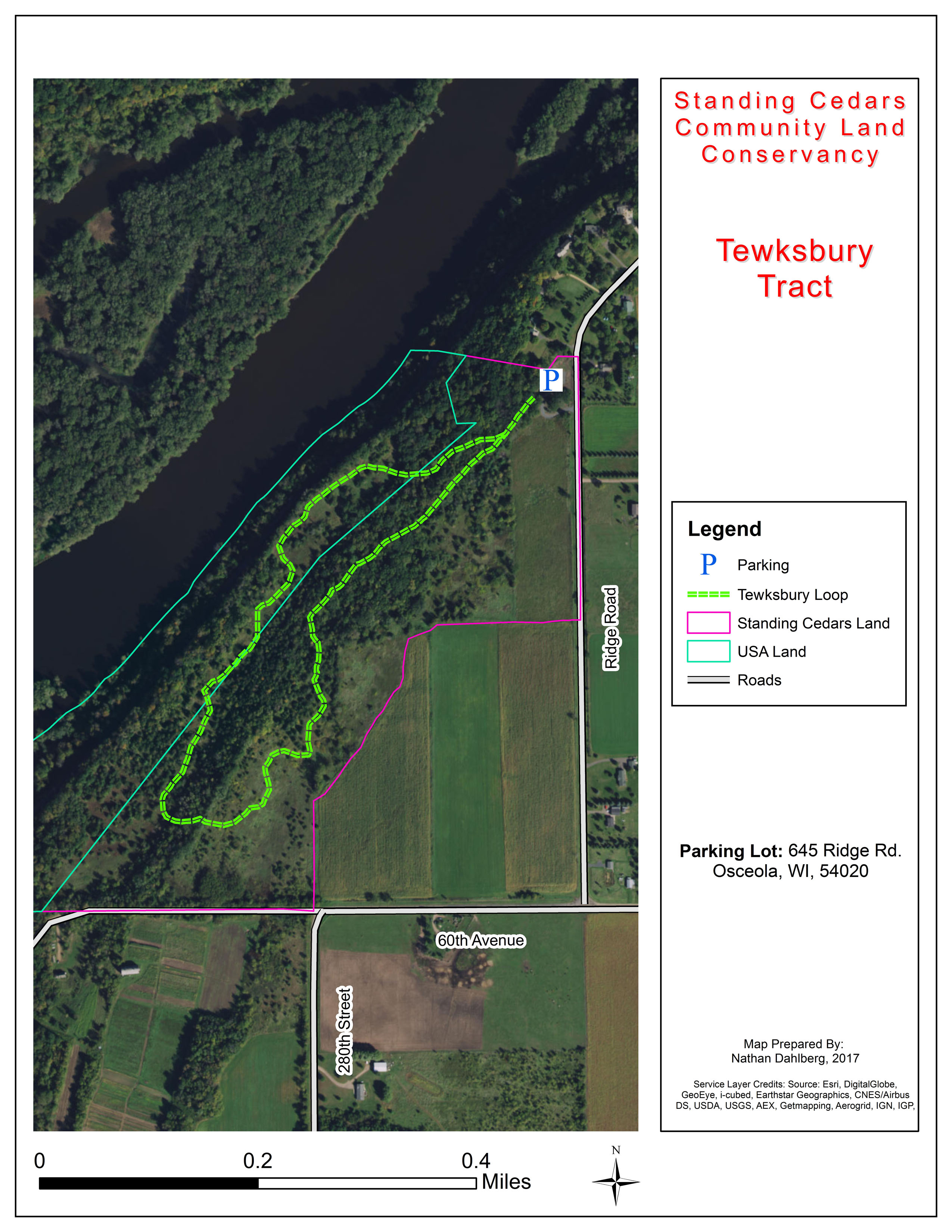
TEWKSBURY TRAIL
TRAIL USES:
SUMMER: HIKING
WINTER: HIKING, SNOWSHOEING
The 50-acre property at Tewksbury offers beautiful views of the St. Croix River. Many wonderful prairie plants grow here, including leadplant, purple prairie clover, grama grass and pasque flowers. As you hike through this site, look for the quarry remnants, old stone foundations and cellars, and clumps of lilac and iris, bearing testimony to the early settlers who tried to farm this sandy, rocky piece of land. Oak savanna follows the ridge between the upper and lower fields. Old growth forest can be found at the north end, in the ravine.
Trailhead address:
645 Ridge Rd
Osceola, WI 54020
MAP IT
TRAIL TYPE: FOOT TRAFFIC
TRAIL LEVEL: EASY
SURFACE: NATURAL
PASS REQUIRED: NO
LENGTH: 50 ACRES
NOTABLES: Views of the St. Croix River
DIFFICULTY LEVEL:easy
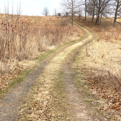
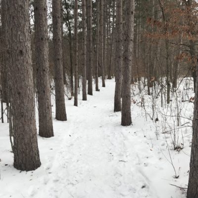
ENGELWOOD TRAIL
TRAIL USES:
SUMMER: HIKING
WINTER: hIKING, SNOWSHOEING, XC SKIING
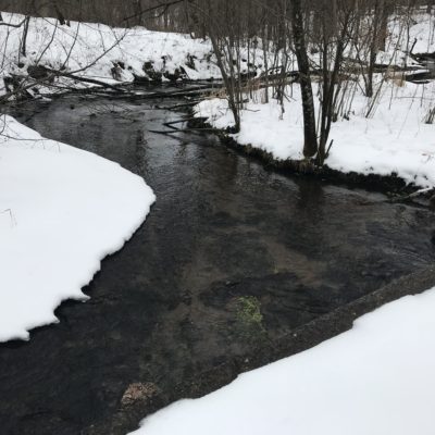
This 1,100 acre area of deep, wooded ravines, rare native prairie, floodplain forest and wetlands was the largest single undeveloped parcel of land on the Lower St. Croix River when it was purchased by Standing Cedars in 1995. Home to a large stand of endangered kittentails, the land has been studied by naturalists who consider it to have potential as a “ark” to preserve rapidly-diminishing prairie species. Specific areas to visit are included below:
The old Engelwood Ski Area, which was in operation during the 1950s and 60s, is a great place to hike. Located on the southern portion of the property, you can still see many of the old ski runs (look for the remains of the rope tows). The views from the tops of these hills are spectacular. A path cuts through the old ski area to the river.
There is an interesting spring just to the south of the path along the river – the water bubbles up through the sand.
Just north of the ski area, at the eastern edge of the property, is a hillside prairie that contains a remarkable variety of prairie plants and grasses.
In the maple Basswood ecosystem at the north end of the property there is a former road that now serves as a trail toward the river. This is a fun trail for cross-country skiing with beautiful views of the St. Croix Valley.
Trailhead address:
215 280th St.
Osceola, WI 54020
MAP IT
A secondary lot is at: 189 280th Street
TRAIL TYPE: FOOT TRAFFIC
TRAIL LEVEL: EASY
SURFACE: NATURAL
PASS REQUIRED: NO
LENGTH: 1,100 ACRES
NOTABLES: Remains of the old Englewood Ski Area are visible.
RIDGEVIEW TRAILS
Two loops make up the Ridgeview Trails: the Osceola Loop and the Chisago Loop. These trails are located north of Osceola along the St. Croix River, and can be accessed off County Road S. This area is part of the Osceola Bedrock Glades area.
DIFFICULTY LEVEL: easy to intermediate
OSCEOLA LOOP
TRAIL USES:
SUMMER: HIKING
WINTER: HIKING, SNOWSHOEING, XC SKIING
Wildlife, birding. Follow a stream toward the St. Croix River.
TRAIL TYPE: FOOT TRAFFIC
TRAIL LEVEL: EASY TO INTERMEDIATE
SURFACE: NATURAL
PASS REQUIRED: NO
LENGTH: 2 MILE LOOP
NOTABLES: NOT GROOMED FOR XC SKIING
DIFFICULTY LEVEL: EASY
CHISAGO LOOP
TRAIL USES:
SUMMER: HIKING
WINTER: HIKING, SNOWSHOEING, XC SKIING
Fabulous views of the St. Croix River. Birding and photography.
TRAIL TYPE: FOOT TRAFFIC
TRAIL LEVEL: EASY
SURFACE: NATURAL
PASS REQUIRED: NO
LENGTH: 1 MILE LOOP
NOTABLES: NOT GROOMED FOR XC SKIING
DRESSER, wi
located just 3 miles south of st. croix falls, wi.
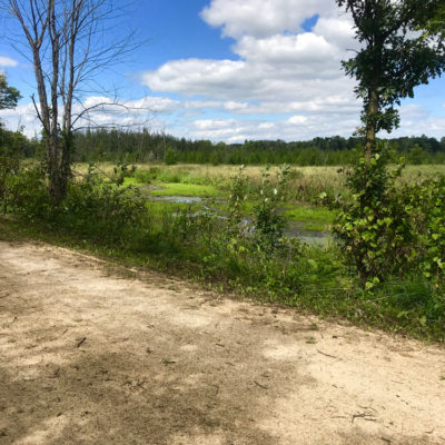
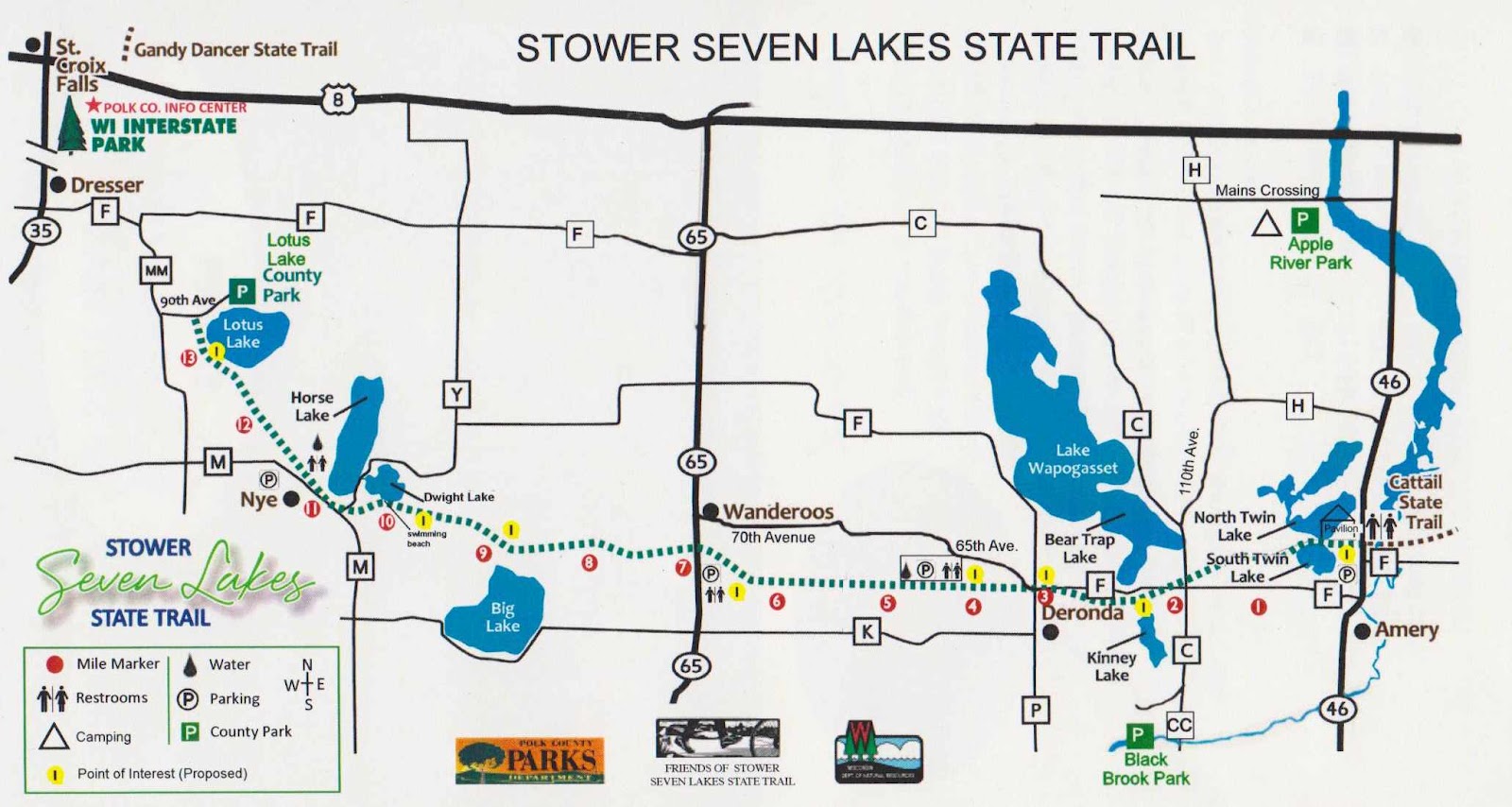
Just outside the small town of Dresser, WI, and just past Trollhaugen Outdoor Recreation area, is the 14 mile Stower Seven Lakes State Trail which stretches from Dresser, WI to Amery, WI.
DIFFICULTY LEVEL: EASY
STOWER SEVEN LAKES STATE TRAIL
TRAIL USES:
SUMMER: BIKING, HIKING.
WINTER: FAT BIKING, HIKING, SNOWSHOEING, CROSS-COUNTRY SKIING
Trailhead Address:
Lotus Lake County Park
2142 90th Ave
Osceola, WI 54020
MAP IT
Note that the trail begins a quarter mile southwest from the Lotus Lake County Park and can be accessed off 90th Avenue.
Built on a former railroad corridor, this 14-mile trail starts about one mile from Dresser, WI and travels through the communities of Nye, Wanderoos, and Deronda, and Amery. The trail passes through maple and oak forests, wetlands, prairies and farmlands and past many picturesque lakes. The seven lakes from west to east are: Lotus, Horse, Dwight, Kinney, Bear Trap Lake, North Twin Lake and South Twin Lake.
The Stower Seven Lakes trail connects to the Cattail trail in Amery that continues to Turtle Lake and beyond. The Cattail Trail uses include hiking, biking, ATV/UTV and snowmobiling.
A State Trail pass is required for bicycling and cross-country skiing for users over the age of 16. Trail passes can be purchased at the Polk County Information Center, DNR stations, various local businesses and certain gas stations. Pass purchases are also available at self-pay stations along the trail, or by calling the DNR at 888-936-7463 between the hours of 7 am – 10 am. Pass fees are $25 annually/$5 daily.
TRAIL TYPE: FOOT AND BIKE TRAFFIC
TRAIL LEVEL: EASY
SURFACE: FLAT, CRUSHED LIMESTONE
PASS REQUIRED: YES FOR BIKES
LENGTH: 14 MILES
Visit the WI-DNR website or the FRIENDS OF THE STOWER SEVEN LAKES TRAIL website for more information.