
HIKING TRAILS & MAPS: FRANCONIA, CENTER CITY, SHAFER, TAYLORS FALLS, LINDSTROM, CHISAGO CITY
Chisago Lakes Trails
CHISAGO LAKES AREA Trails

In addition to MN Interstate State Park, there are many regional trails within the Chisago Lakes Boundaries.
Find your favorite trail!
TAYLORS FALLS, MN
located along the st. croix River ACROSS FROM ST. CROIX FALLS, WI.
Taylors Falls is mostly known for the beautiful hiking trails inside of MN Interstate State Park, but this quaint river town is also home to a few other little known trails within city limits.
DIFFICULTY LEVEL:EASY
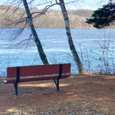
TAYLORS FALLS LIONS PARK
TRAIL USES:
SUMMER: HIKING
WINTER: HIKING, SNOWSHOEING
Trailhead addresses:
NORTH
1751 Chisago St,
Taylors Falls, MN 55084
MAP IT
SOUTH
Chisago St
Taylors Falls, MN 55084
MAP IT
The Lions Park in Taylors Falls has a north and south access and sits on over 100 wooded acres. The Lions Park is located along the scenic St. Croix River and features a boat landing, canoe access, fishing, pavilions, picnic tables, grill posts, restrooms, playground equipment and a volleyball court. A .5 mile trail connects the north and south park.
TRAIL TYPE: FOOT TRAFFIC
TRAIL LEVEL: EASY
SURFACE: NATURAL, DIRT
PASS REQUIRED: NO
LENGTH: .5 MILES
NOTABLES: Trail connects the north and south parks. River landing access is above the hydroelectric dam.
DIFFICULTY LEVEL: easy to intermediate
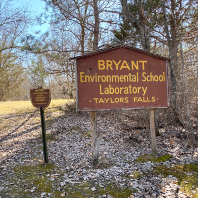
BRYANT WOODS
TRAIL USES:
SUMMER: HIKING
WINTER: HIKING, SNOWSHOEING
Trailhead Address
Furuby Road/Hwy 20
Taylors Falls, MN 55084
MAP IT
Bryant Woods, also known as Bryant Environmental School Laboratory, is a 60 acre park reserve owned by Chisago Lakes School District. The 60 acre reserve features a half mile of rustic trails and rich natural resources. The property includes basalt rock outcrops, mature forests, and an abundance of wildlife.
TRAIL TYPE: FOOT TRAFFIC
TRAIL LEVEL: EASY TO INTERMEDIATE
SURFACE: NATURAL
PASS REQUIRED: NO
LENGTH: .5 MILES
NOTABLES: Parking is limited.
DIFFICULTY LEVEL: EASY
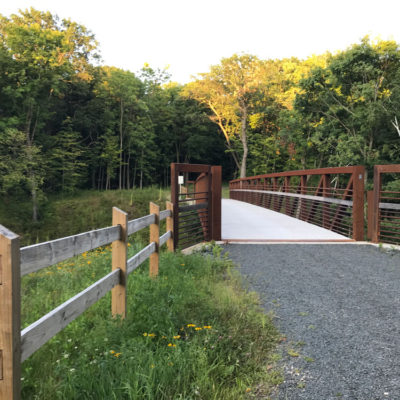
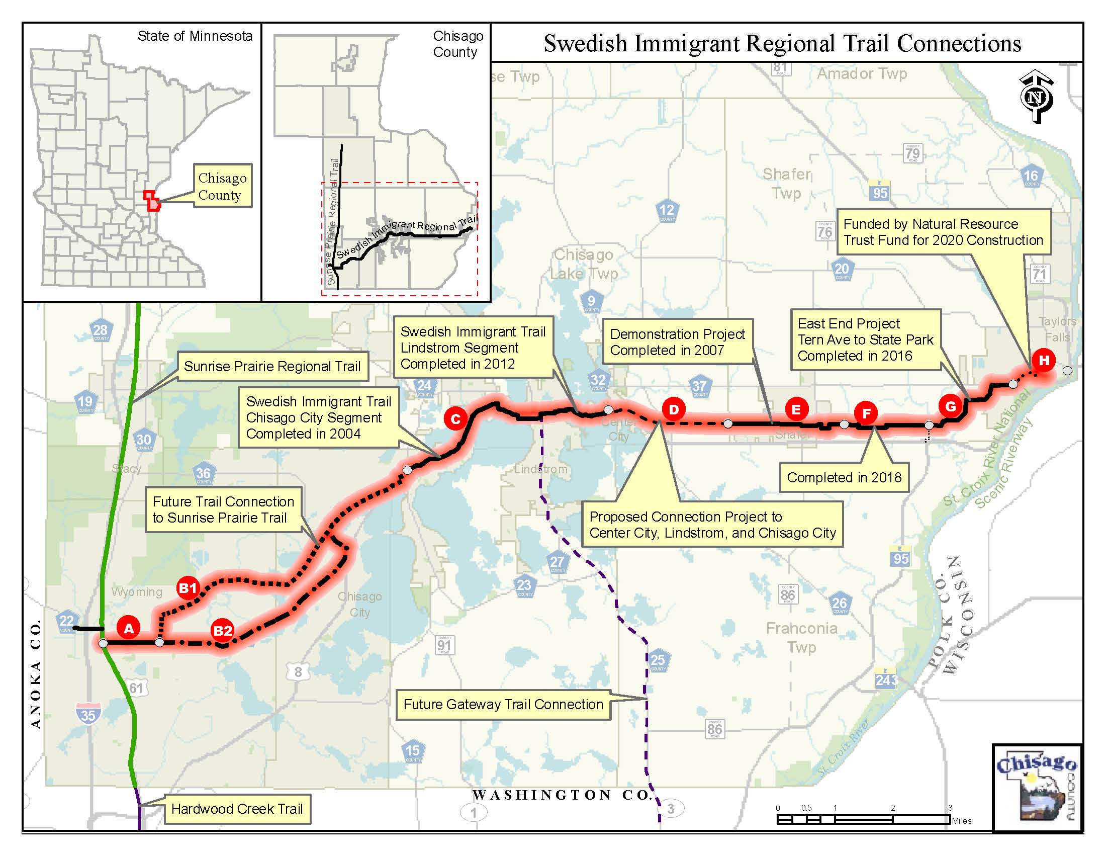
SWEDISH IMMIGRANT REGIONAL TRAIL
TRAIL USES:
SUMMER: BIKING, HIKING. IN-LINE SKATING
WINTER: FAT BIKING, HIKING, SNOWSHOEING
Trailhead Address:
30269 Tern Avenue
Shafer, MN 55074
MAP IT
The Swedish Immigrant trail is a hard surface, muti-use trail connecting the city of Taylors Falls, MN to the city of Wyoming, MN. When complete, this trail will span 22 miles. The last portion of the trail, “segment H”, is scheduled to be completed in 2020.
TRAIL TYPE: MULTI-USE, HARD SURFACE
TRAIL LEVEL: EASY. DESIGNED FOR ACCESSIBILITY WITH REQUIRED GRADES.
SURFACE: HARD SURFACE/PAVED & CRUSHED ROCK.
PASS REQUIRED: NO
LENGTH: 22 MILES
Visit the CHISAGO COUNTY website for more information.
A MN STATE PARK LOCATED IN TAYLORS FALLS, MN
INTERSTATE PARK MN
Gorgeous views of the St. Croix River as well as scenic wooded trails can be found at MN Interstate Park. Find your favorite trail!