Deer Lake is located in western Wisconsin, five miles east of the beautiful and historic St. Croix River Valley. Between the lake and the river are many large gorges in the rocks, left by glaciers over 12,000 years ago.
These gorges, many over 100 feet deep, are called dalles. The lake is spring fed both internally and externally and covers over 840 acres with a maximum depth of 46 feet. A small dam at the east end of the lake helps assure a near constant water level.
The interesting and colorful trees lining the shoreline include towering evergreens and oaks.
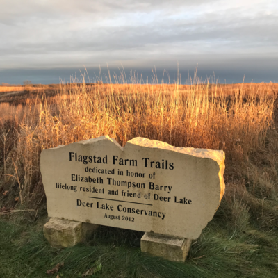
The purpose of the organization is the preservation of Deer Lake and the surrounding land that contributes to the natural, recreational and productive value of the lake.
DIFFICULTY LEVEL: easy
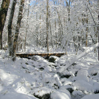
rOCK CREEK
TRAIL USES:
SUMMER: HIKING
WINTER: hIKING, SNOWSHOEING
Trailhead address:
Off 140th Ave, north of Deer Lake St. Croix Falls, WI MAP IT
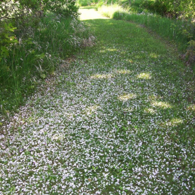
40 acres of prairie and woodlands. The trail enters the woods at the south end of the prairie Cool spring ponds and trap rock boulders can be found.
TRAIL TYPE: FOOT TRAFFIC
TRAIL LEVEL: EASY
SURFACE: NATURAL
PASS REQUIRED: NO
LENGTH: 1 MILE LINEAR
NOTABLES: Prairie restoration area. In 1998, 50 species of native flowers and grasses were planted to create the 20 acre prairie.
Off 140th Ave, north of Deer Lake St. Croix Falls, WI MAP IT
10 acres of native prairie were planted in 1999 to provide habitat for butterflies and grassland birds. Trail circles around the wetland restoration area.
A 106-acre preserve along the Balsam Branch that flows through central Polk County. A prairie restoration area features native grasses and wildflowers. The park includes a dam, millpond, and well-maintained trails. It provides a variety of habitat for a good mix of birds. Fishing from a bridge and handicap accessible pier, interpretive hiking trails, a picnic area w/grills, shelter, and restrooms. 11 km of trails groomed for XC skiing.
TRAIL TYPE: FOOT TRAFFIC
TRAIL LEVEL: EASY
SURFACE: PAVED & NATURAL
PASS REQUIRED: NO
LENGTH: 106 acres
NOTABLES: Watch for muskies spawning in early spring.
Trailhead address: 120th Ave Amery, WI 54001 MAP IT
Balsam Branch Wildlife Area is a 180-acre property located in Polk County. The property consists of marsh, pond, prairie grass fields, stream bottom, upland and lowland forest.
Groomed for classic and skate-skiing, this 10-mile recreation trail crosses the D.D. Kennedy Environmental Area, the Garfield Recreation Area, and Lake Wapogasset Bible Camp. Parking and trail access are available at D.D. Kennedy Park and Garfield Recreation Area.
Adjacent to DD Kennedy park.
TRAIL TYPE: FOOT TRAFFIC
TRAIL LEVEL: EASY
SURFACE: NATURAL
PASS REQUIRED: NO
LENGTH: 11 KM
NOTABLES: 11 km of trails groomed for XC skiing in winter.