
RAIL TO TRAIL BIKE TRAILS

Sixty-four miles of rails-to-trails originate in the St. Croix Valley area. Hard-packed, crushed limestone or paved surface provides ideal surfaces to enjoy car-free riding throughout the woods, farm fields, lakes, ponds, and streams. Family Friendly!
DIFFICULTY LEVEL: EASY
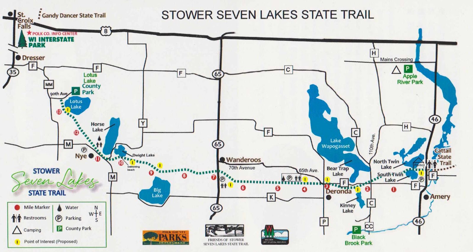
STOWER SEVEN LAKES
TRAIL USES:
SUMMER: BIKING, HIKING.
WINTER: FAT BIKING, HIKING, SNOWSHOEING, CROSS-COUNTRY SKIING
Trailhead Address:
Lotus Lake County Park, 2142 90th Ave – Osceola, WI 54020
MAP IT
Note that the trail begins a quarter mile southwest from the Lotus Lake County Park and can be accessed off 90th Avenue.
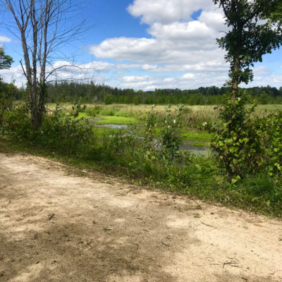
Built on a former railroad corridor, this 14-mile trail starts about one mile from Dresser, WI and travels through the communities of Nye, Wanderoos, and Deronda, and Amery. The trail passes through maple and oak forests, wetlands, prairies and farmlands and past many picturesque lakes. The seven lakes from west to east are: Lotus, Horse, Dwight, Kinney, Bear Trap Lake, North Twin Lake and South Twin Lake.
The Stower Seven Lakes trail connects to the Cattail trail in Amery that continues to Turtle Lake and beyond. The Cattail Trail uses include hiking, biking, ATV/UTV and snowmobiling.
A State Trail pass is required for bicycling and cross-country skiing for users over the age of 16. Trail passes can be purchased at the Polk County Information Center, DNR stations, various local businesses and certain gas stations. Pass purchases are also available at self-pay stations along the trail, or by calling the DNR at 888-936-7463 between the hours of 7 am – 10 am. Pass fees are $25 annually/$5 daily.
TRAIL TYPE: RAIL TO TRAIL
TRAIL LEVEL: EASY
SURFACE: FLAT, CRUSHED LIMESTONE
PASS REQUIRED: YES
LENGTH: 14 MILES
Visit the WI-DNR website or the FRIENDS OF THE STOWER SEVEN LAKES TRAIL website for more information.
DIFFICULTY level: easy
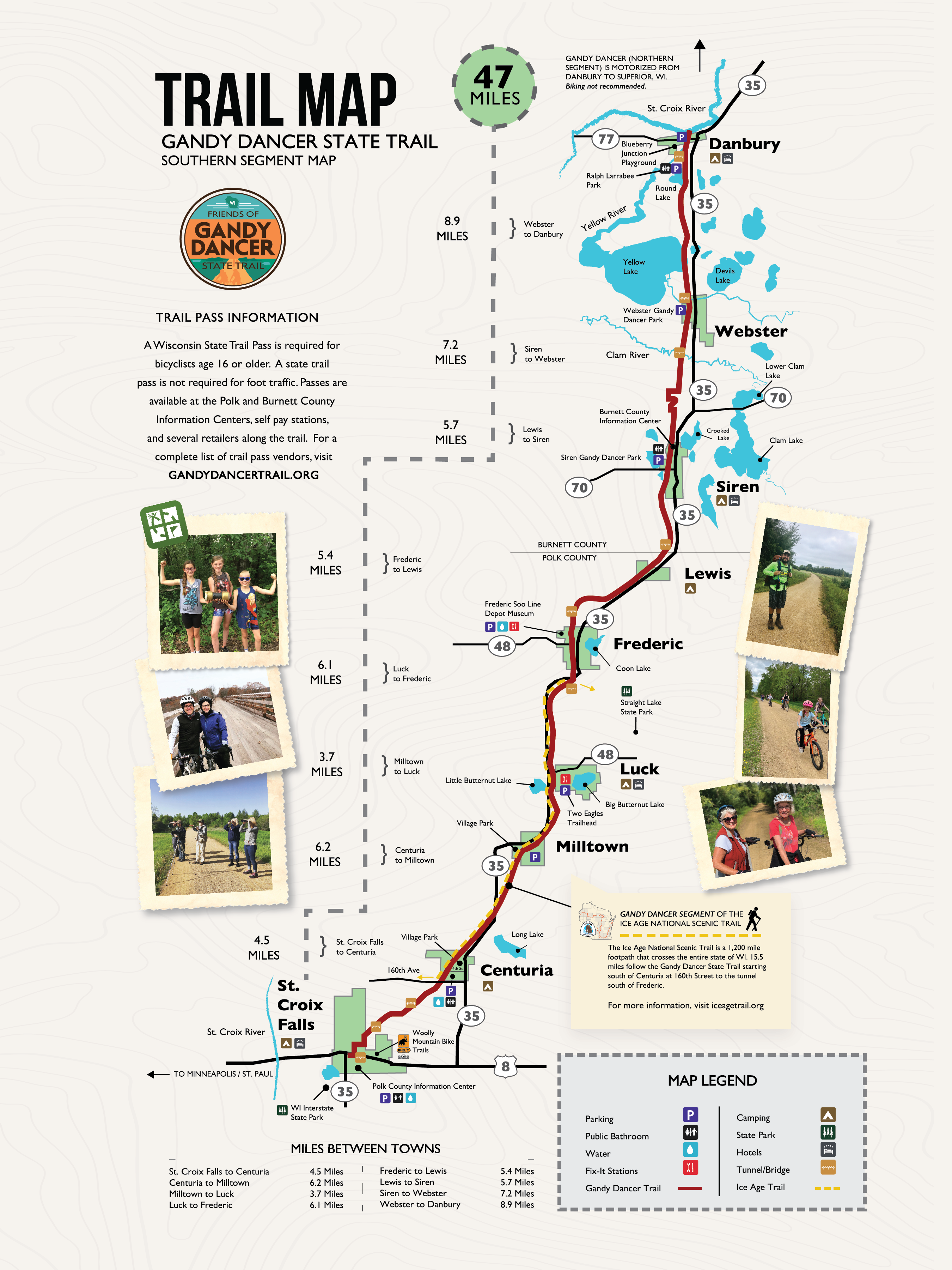
GANDY DANCER STATE TRAIL
TRAIL USES:
SUMMER: BIKING, HIKING.
WINTER: FAT BIKING, HIKING, SNOWSHOEING, SNOWMOBILE AND FROZEN GROUND ATV/UTV USE.
Trailhead Address:
Polk County Information Center – 710 Highway 35 S, Saint Croix Falls, Wisconsin 54024
MAP IT
The 98-mile recreation trail follows the railroad grade from St. Croix Falls north to Superior. Recreational use on the Trail is divided by geographic location: south half and north half. Enjoy a short stroll or a longer bike ride.
The south trail segment extends 47 miles from St. Croix Falls to Danbury, paralleling Hwy. 35 most of the distance. This segment was surfaced with crushed limestone in 1995 and offers a smooth, hard surfaced trail with use limited to biking and hiking from April through November. Spice up your adventure by stopping at the many small towns for a coffee or bite to eat along the way!
A State Trail pass is required of all bicyclists 16 years of age or older riding the Gandy Dancer Trail between St. Croix Falls and Danbury. Trail passes can be purchased at the Polk County Information Center, DNR stations, various local businesses and certain gas stations. Pass purchases are also available at self-pay stations along the trail, or by calling the DNR at 888-936-7463 between the hours of 7 am – 10 am. Pass fees are $25 annually/$5 daily. A Wisconsin Department of Natural Resources Conservation Patron license will be honored as a bike pass.
Distances
Mileage between southern towns along the Gandy Dancer Trail are as follows.
| St. Croix Falls to Centuria | 4.5 Miles |
| Centuria to Milltown | 6.2 Miles |
| Milltown to Luck | 3.7 Miles |
| Luck to Frederic | 6.1 Miles |
| Frederic to Lewis | 5.4 Miles |
| Lewis to Siren | 5.7 Miles |
| Siren to Webster | 6.6 Miles |
| Webster to Danbury | 8.9 Miles |
TRAIL TYPE: RAIL TO TRAIL
TRAIL LEVEL: EASY
SURFACE: FLAT, CRUSHED LIMESTONE
PASS REQUIRED: YES
LENGTH: 98 MILES
Visit the WI-DNR website for more trail information.
DIFFICULTY LEVEL: EASY
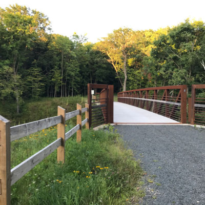
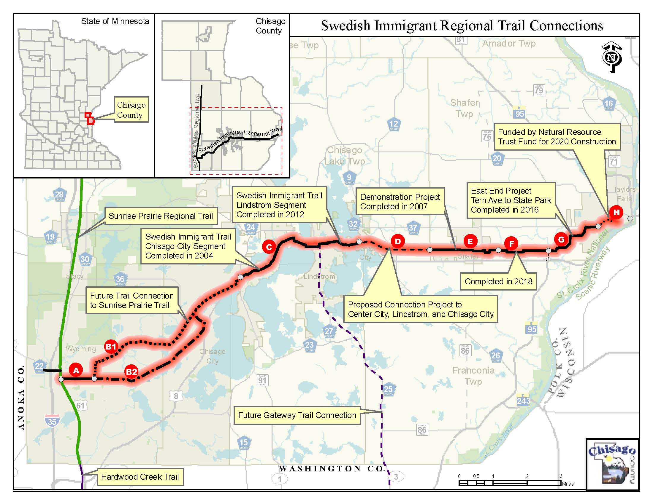
SWEDISH IMMIGRANT REGIONAL TRAIL
TRAIL USES:
SUMMER: BIKING, HIKING. IN-LINE SKATING
WINTER: FAT BIKING, HIKING, SNOWSHOEING
Trailhead Address:
30269 Tern Avenue – Shafer, MN 55074
MAP IT
The Swedish Immigrant trail is a hard surface, muti-use trail connecting the city of Taylors Falls, MN to the city of Wyoming, MN. When complete, this trail will span 22 miles. The last portion of the trail, “segment H”, is scheduled to be completed in 2020.
TRAIL TYPE: MULTI-USE, HARD SURFACE
TRAIL LEVEL: EASY. DESIGNED FOR ACCESSIBILITY WITH REQUIRED GRADES.
SURFACE: HARD SURFACE/PAVED & CRUSHED ROCK.
PASS REQUIRED: NO
LENGTH: 22 MILES
Visit the CHISAGO COUNTY website for more information.