
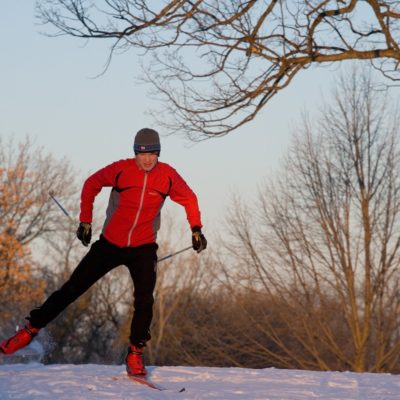
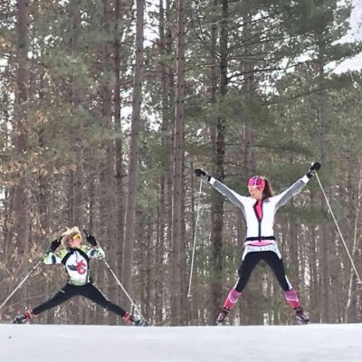
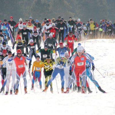
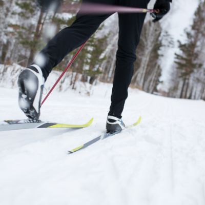
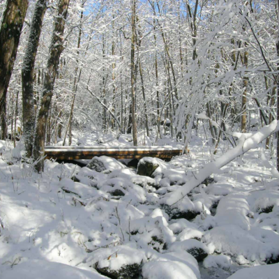
CROSS COUNTRY SKIING

Truly world class Nordic Skiing abounds in St. Croix Falls! From lighted, human-made snow loops, to challenging terrain, all level of skiers will find their fun. Birkie training right in our backyard!
difficulty levels: Easy, intermediate, & advanced trails
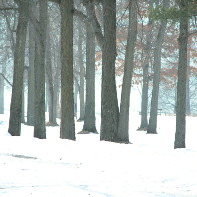
INTERSTATE PARK–WI
12.5 MILES OF WINTER TRAILS.
SKI, HIKE, SNOWSHOE
PARK ADDRESS:
1275 State Highway 35
St. Croix Falls, WI 54024
715-483-3747
MAP IT
The 2.8 mile Skyline Trail is a groomed ski trail. Other trails are multi-use for hiking & snowshoe. A WI State Park Pass is required for all trails. WI Residents: $28 annual/$8 daily fee. Non Residents: $38 annual/$11 daily fee. (2020 rates. Subject to change per the WI-DNR. For a full list of rates, go here.)
difficulty levels: Easy, intermediate, & advanced trails
BALSAM BRANCH WILDLIFE AREA
10 MILES OF WINTER TRAILS
SKI, HIKE, SNOWSHOE
Trailhead address:
120th Ave
Amery, WI 54001
MAP IT
Balsam Branch Wildlife Area is a 180-acre property located in Polk County. The property consists of marsh, pond, prairie grass fields, stream bottom, upland and lowland forest.
Groomed for classic and skate-skiing, this 10-mile recreation trail crosses the D.D. Kennedy Environmental Area, the Garfield Recreation Area, and Lake Wapogasset Bible Camp. Parking and trail access are available at D.D. Kennedy Park and Garfield Recreation Area.
11 km of trails. 4 k lit.
Adjacent to DD Kennedy park.
Photo © Frank Lundeen
DIFFICULTY LEVEL: EASY
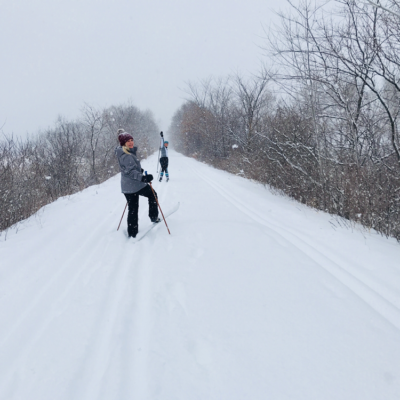
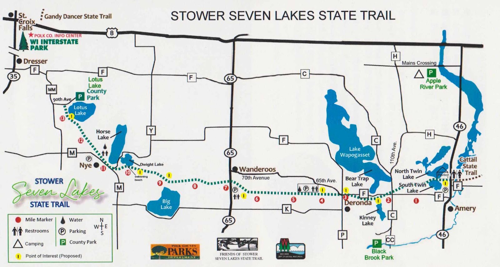
STOWER SEVEN LAKES STATE TRAIL
14 MILES OF WINTER TRAILS
SKI, HIKE, SNOWSHOE, FAT BIKE
Trailhead Address:
2061 75th Ave
Osceola, WI 54020
MAP IT
Built on a former railroad corridor, this 14-mile trail starts about one mile from Dresser, WI and travels through the communities of Nye, Wanderoos, and Deronda, and Amery. The trail passes through maple and oak forests, wetlands, prairies and farmlands and past many picturesque lakes. The seven lakes from west to east are: Lotus, Horse, Dwight, Kinney, Bear Trap Lake, North Twin Lake and South Twin Lake.
The Stower Seven Lakes trail connects to the Cattail trail in Amery that continues to Turtle Lake and beyond. The Cattail Trail uses include hiking, biking, ATV/UTV and snowmobiling.
A State Trail pass is required for bicycling and cross-country skiing for users over the age of 16. Trail passes can be purchased at the Polk County Information Center, DNR stations, various local businesses and certain gas stations. Pass purchases are also available at self-pay stations along the trail, or by calling the DNR at 888-936-7463 between the hours of 7 am – 10 am. Pass fees are $25 annually/$5 daily.
Visit the WI-DNR website or the FRIENDS OF THE STOWER SEVEN LAKES TRAIL website for more information.
difficulty level: intermediate
WERT PRESERVE
450 ACRES
SKI, HIKE, SNOWSHOE, FAT BIKE
Trailhead Address:
HWY 87/240th St
St. Croix Falls, Wisconsin 54024
MAP IT
Within the City of Trails lies 450 acres of protected woodland. Offering ski trails, hiking trails, and wildlife viewing/sanctuary. This land was preserved by the community of Saint Croix Falls, the Wert family, the West Wisconsin Land Trust, the Conservation Fund, the Ice Age Trail Foundation, and the Warren Knowles-Gaylord Nelson Stewardship Fund. Located across the highway from the St. Croix Falls Lions Park.
Non -groomed.
Photo © Lindsay Nichols
DIFFICULTY LEVEL: EASY, INTERMEDIATE & ADVANCED TRAILS
WILLIAM O'BRIEN STATE PARK
17 WINTER TRAILS
SKI, HIKE, SNOWSHOE
PARK ADDRESS:
16821 O’Brien Trail North
Marine on St. Croix, MN 55047
651-539-4980
MAP IT
7 Trails groomed and designated ski-only trails. For a list of individual trails, go here.
A MN State Park Pass is required for all trails. $35 annual/$7 daily fee. (2020 rates. Subject to change per the MN-DNR. For a full list of rates, go here.)
PHOTO © Jeni O’Brien
DIFFICULTY LEVEL: EASY, INTERMEDIATE, & ADVANCED TRAILS
WILD RIVER STATE PARK
37+ mILES OF WINTER TRAILS
SKI, HIKE, SNOWSHOE
PARK ADDRESS:
39797 Park Trail
Center City, MN 55012
651-583-2125
MAP IT
About 14 miles of beginner trails, 16 miles of intermediate trails, and 3 miles of advanced trails await cross country skiers. Seventeen miles of trails are groomed for combined cross country and skate skiing. For a full list of individual trails, go here.
A MN State Park Pass is required for all trails. $35 annual/$7 daily fee. (2020 rates. Subject to change per the MN-DNR. For a full list of rates, go here.)
DIFFICULTY LEVEL: EASY
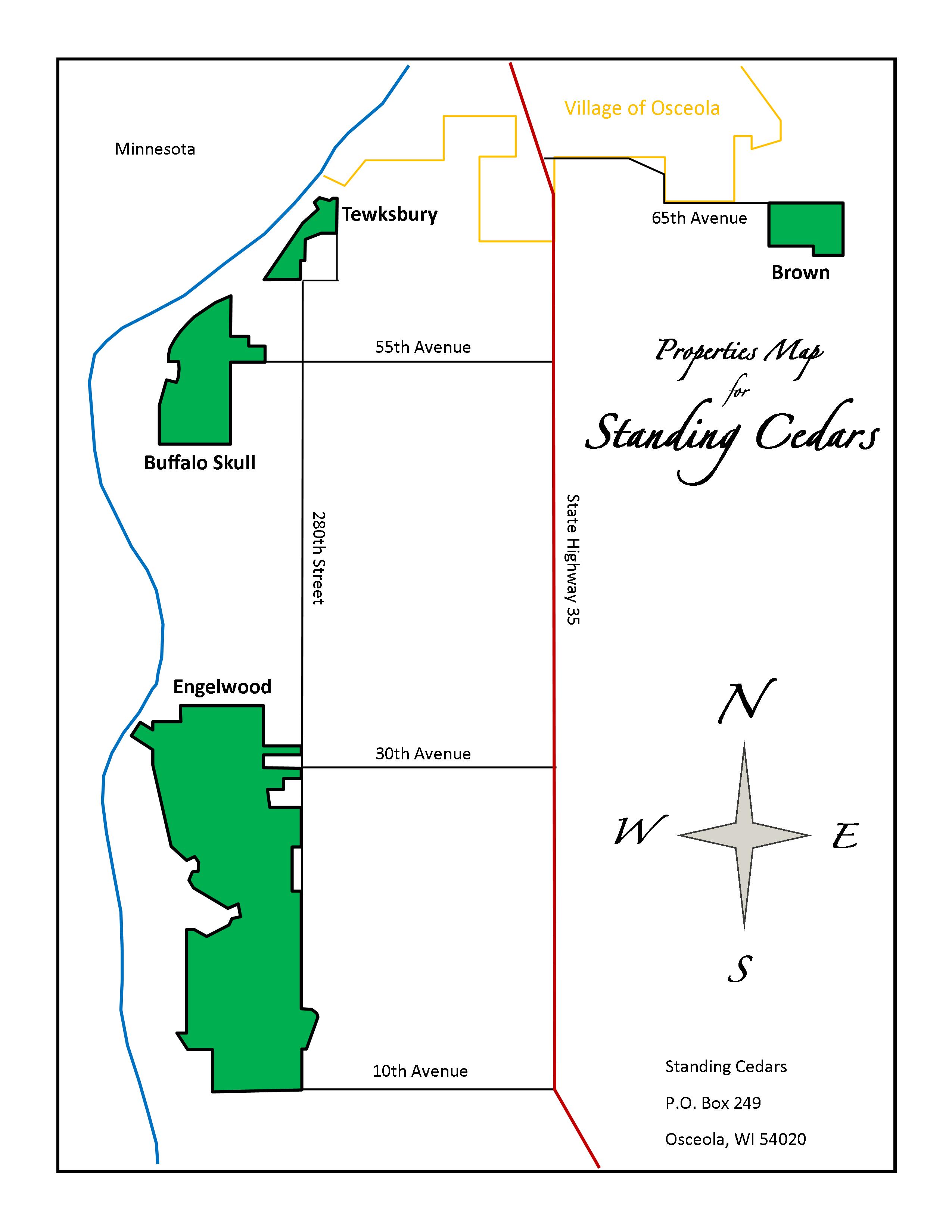
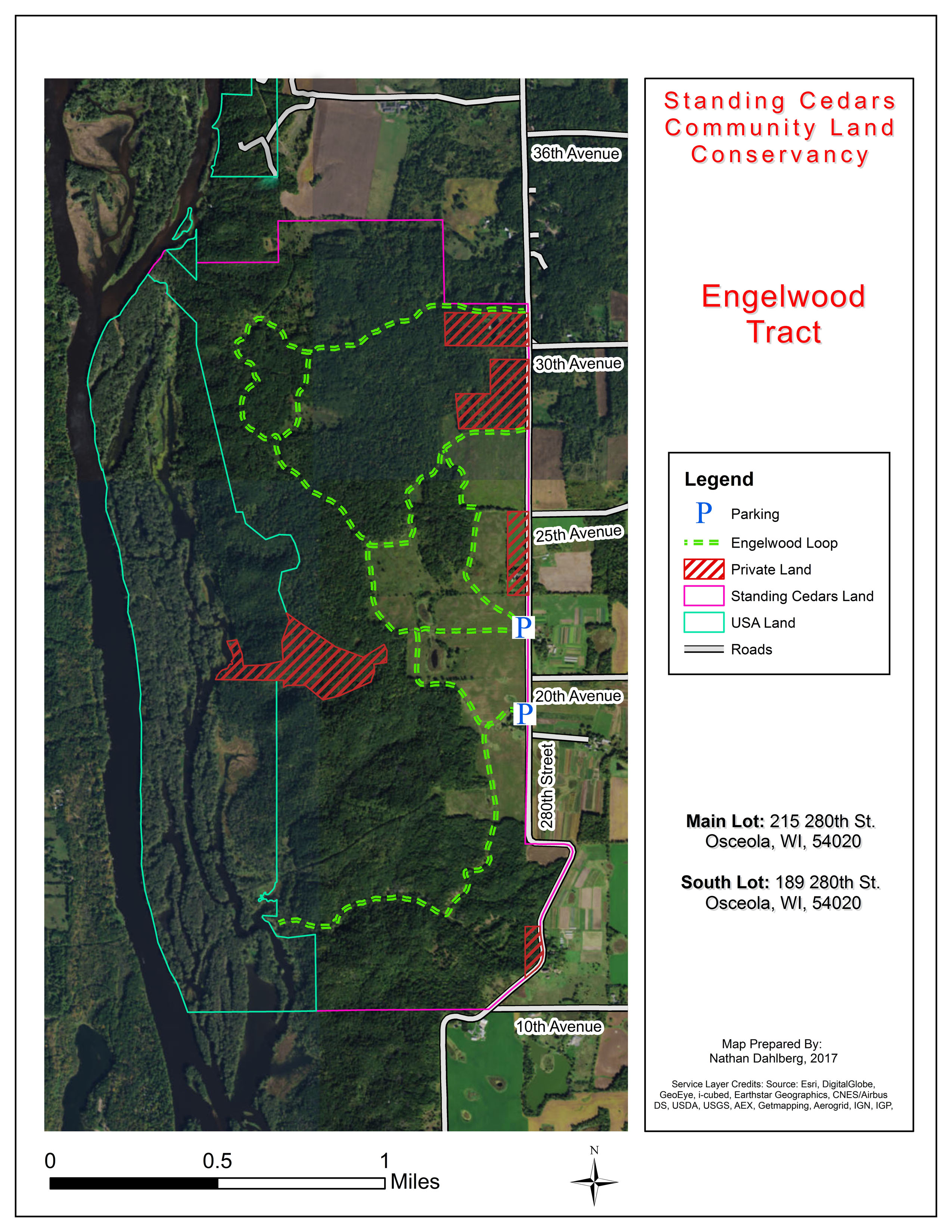
1,500 ACRES OPEN TO THE PUBLIC
SKI, HIKE, SNOWSHOE
Four areas are open to the public: Englewood, Tewksbury, Buffallo Skull, Brown. For full descriptions of all, go here.
Englewood is best suited for XC skiing.
This 1,100 acre area of deep, wooded ravines, rare native prairie, floodplain forest and wetlands was the largest single undeveloped parcel of land on the Lower St. Croix River when it was purchased by Standing Cedars in 1995. Home to a large stand of endangered kittentails, the land has been studied by naturalists who consider it to have potential as a “ark” to preserve rapidly-diminishing prairie species. Specific areas to visit are included below:
The old Engelwood Ski Area, which was in operation during the 1950s and 60s, is a great place to hike. Located on the southern portion of the property, you can still see many of the old ski runs (look for the remains of the rope tows). The views from the tops of these hills are spectacular. A path cuts through the old ski area to the river.
There is an interesting spring just to the south of the path along the river – the water bubbles up through the sand.
Just north of the ski area, at the eastern edge of the property, is a hillside prairie that contains a remarkable variety of prairie plants and grasses.
In the maple Basswood ecosystem at the north end of the property there is a former road that now serves as a trail toward the river. This is a fun trail for cross-country skiing with beautiful views of the St. Croix Valley.
Trailhead address:
215 280th St.
Osceola, WI 54020
MAP IT
A secondary lot is at: 189 280th Street
DIFFICULTY LEVEL: EASY
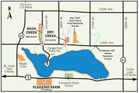
dEER LAKE CONSERVANCY
120 aCRES OPEN TO THE PUBLIC
SKI, HIKE, SNOWSHOE
Deer Lake is located in western Wisconsin, five miles east of the beautiful and historic St. Croix River Valley. Between the lake and the river are many large gorges in the rocks, left by glaciers over 12,000 years ago.These gorges, many over 100 feet deep, are called dalles. The lake is spring fed both internally and externally and covers over 840 acres with a maximum depth of 46 feet. A small dam at the east end of the lake helps assure a near constant water level.
The interesting and colorful trees lining the shoreline include towering evergreens and oaks.
The purpose of the organization is the preservation of Deer Lake and the surrounding land that contributes to the natural, recreational and productive value of the lake.
Three areas are open to the public: Rock Creek, Dry Creek, and Flagstad Farms. For more information on the individual areas, go here.
Trailhead address:
Rock Creek & Dry Creek
Off 140th Ave, north of Deer Lake
St. Croix Falls, WI
MAP IT
Flagstad Farms
Off Hwy 8, south of Deer Lake
St. Croix Falls, WI
MAP IT
Photo © Deer Lake Conservancy